Industry News
Nairobi maps its future with new city master plan
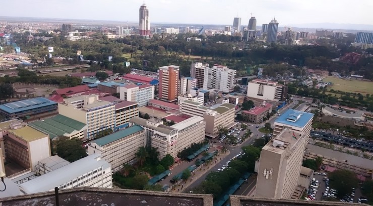
The masterplan proposes the creation of more than a dozen commercial centres.

The Nairobi County government has unveiled a new development masterplan that is hinged on construction of new rail and road network, among other things, to ease congestion in the central business district (CBD).
The Nairobi Integrated Urban Development Master Plan (Niuplan), which was prepared by City Hall with support from the Japanese International Cooperation Agency (JICA), provides a guiding framework to manage Nairobi metropolitan development from 2014-2030.
The Nairobi masterplan proposes the creation of more than a dozen commercial centres to create multiple economic arteries in the city in a bid to disperse activity away from the CBD.
Areas earmarked for development include Uthiru, Kabete, Kasarani, Runda, Ruiru, Ruai, Lang’ata, Donholm and Ruaraka.
Donholm and Airport North have been earmarked for industrial and commercial services while Kabete and Uthiru have been reserved for development as office and commercial centres. On its part, Kasarani will be developed into commercial, residential and entertainment district.
The commercial centres will be served by major transport passageways that are linked to Thika Road, Mombasa Road and the Northern, Southern and Eastern by-passes. The centres will be interconnected by a network of metro railway lines.
The master plan also proposes to alter the land use zoning and plot ratios in areas earmarked for development to allow developers to build office blocks in high-end estates such as Runda and Karen.
It also proposes to demolish old estates in Eastlands to create way for construction of highrise buildings that can accommodate more people.
“If Nairobi County needs to accommodate more than 5 million people, the existing regulation in Development Ordinance must be revised to change land use to convert some of the non-residential land to residential use and change plot ratio to higher value to promote higher population density,” says the report.
The proposals are expected to face fierce opposition from residents of the respective areas. In June 2012, City Hall agreed to suspend rezoning of the city neighbourhoods following a petition by the Nairobi Group of Residents’ Associations.
READ: City Hall suspends Nairobi rezoning plans
The development blueprint proposes a Mass Rapid Transit System along the city’s major transport corridors to enhance transport system in the CBD. Under the plan, a special lane will be set aside for buses in bold plan to change public transport – one of the biggest challenges facing the city.
Several roads will also run light commuter railway lines. Roads earmarked for the rapid transit corridors include Waiyaki Way, Mombasa Road, Thika Road, Lang’ata Road, Outer Ring Road and Juja Road.
“Additionally, a circular mass transit route surrounding the CBD is proposed to create high accessibility and reduce vehicle transport,” adds the report that proposes to kick matatus out of the city centre.
The 2030 metropolitan masterplan expects that vast tracts owned by the Kenya Railways will be used to build a railway city while electricity way-leaves will provide land for infrastructure development.
READ: Kenya Railways’ ambitious plans for Nairobi golf city
Nairobi last developed a masterplan in 1973. The plan was meant to guide the city’s development till the year 2000 – meaning the metropolitan has been operating without a blueprint for the past 14 years.


